Thursday 26 November 2015

Dufferin km 29.4 to km 41.7 - 25 November, 2015

Section from the BTC Parking Lot on 1st Line East just south od Dufferin County Road 17 to the intersection of Prince of Wales Drive and 20 Sideroad in Mulmur Township.

We got out of our car as the sun broke through the early morning fog with a temperature of about -3C. It remained a sunny day with temperature rising to about 5C.


Today's hikers; Andy, Karen our leader, Steve and Case.
We started out at the BTC parking area and walked about 120m north on
1st Line East before turning left into a forest of cedar and alder. 

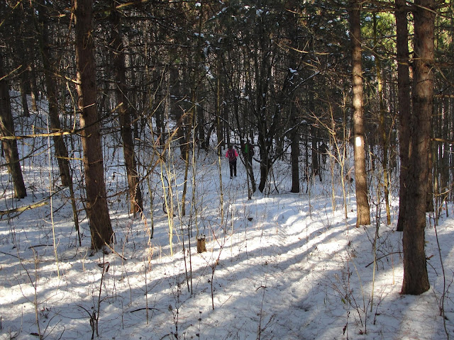
As you can see we had about 2 inches of nice white snow underfoot.

The Trail follows the base of a dolostone outcrop and eventually reaches the top where
 crevices and caves abound.


At the top of the escarpment the trail passes through a mature hardwood bush.

The Trail breaks out onto County Road #17 and we turn right at Whitfield Church
onto Centre Road.

The Trail follows Centre Road north and make a lengthy descent into the Pine River Valley
 arriving at the River Road. We follow the River Rd for 200 m and turn left just before a 
bridge over the Pine River.


The Trail enters the Pine River Provincial Fishing Area and follows the riverbank past the 
 concrete shell of the Dufferin Light and Power Company generating station. 


The Trail turns right and follows the banks of the Pine River Fishing Pond.


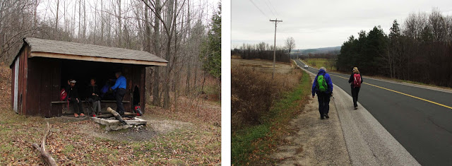
We took a 70 m side trail to the Bell Lookout where we had our Elevnsies.


We attempted to identify the many tracks the appeared in the fresh snow.
The prints on the left are Lepus europaeus, most common Hare in Southern Ontario.
The track on the right was identified as that of the  Andras Debreceni, rare north of the
GTA but recently spotted along various sections of the Bruce Trail

The print on the left is most likely that of a Odocoileus virginianus or commonly know
 as a 
White Tailed Deer. The trail on the right looks like that of a dog but Steve was
adamant that it must be a Lynx rufus, commonly know as the Bobcat.


The Trail goes through mixes forests and after climbing to a lookout desceenda to
Prince of Wales Road which we then folow back to our car. We picked up the other car
drove to Timmy's at Orangeville for sustinance and then home to Oakville

Friday 20 November 2015

Dufferin km 41.7 to km 56.3 - 19 November, 2015

Section from the intersection of Prince of Wales Drive and 20 Sideroad in Mulmur Township to the intersection of Lavender Hill Road and Centre Road on the Mulmur/Nottawasaga Townline.
 .
The weather started out cloud covered,and windy, The sun broke out about 11 am with temp. at about 13C.

Today's hikers, Case, Ann, Andy and our leader Karen.
After getting our gear on we started the 700m climb up the 20 Sideroad.where the
Trail turns right and we climb over the first of many stiles.


Passing through a mature hardwood forest, where we signed a 'Guest Book',
the Trail climbs steeply to reach an open ridge with spectacular views to the east.


A pair of Ancient Druid Temples
((or a pair of farm silos)


The Trail follows the Black Bank Creek for about 50m then crosses and climbs steeply
up the slope of the valley.


The Trail turns left onto the Mulmur / Nottawasaga Townline and we hike towards the
Lavender Hill Cemetery where the car is parked.


.....

Wednesday 11 November 2015

Blue Mountain km 0.0 to km 16.3 - 10 November, 2015

Section from the intersection of Lavender Hill Road and Centre Road to the intersection of Concession 10, South Nottawasaga and 12/13th Sideroad Nottawasaga.

The weather started out sunny and warm until about noon when it clouded over and got a bit cooler. Perfect hiking weather. It started to rain as we got into the cars to head home.

Hikers; Karen, our leader, Andy, Christine and Case - This was a makeup hike for Andy and Case.
We left Oakville at 7 am and saw a lot of frost on the ground north of the GTA. We met in Shelbourne at Tim's 
for morning coffee, dropped off the first car at the end  drove back to the Lavender Cemetary to start our hike.


We struck out north from the cemetary for m 550 to the tiny community of Lavender
where the Blue Mountain Section actually starts.
At km 1.4 the Trail enters the Noisy River Nature Preserve. Over the next 2 kms the Trail moves 
in and out of the woods and crosses pasture land to reach the escarpment edge and a senic outlook.


The Trail crosses the Noisy River where we begin the climb out of the valley. After a stop for elevesies 
we reach Simcoe Roadd 9, turn right for km 650 and turn left onto Concession 10.

Cattails going to seed


Refurbished School House at the corner of 6/7 Sideroad and 10th Concession.


Hiker's lunch                                                                  Woodpecker's lunch


We hiked north on the 10th Concession to the 12/13 Sideroad where the car was parked.
After another successful and satisfying hike we arrive at the car just as it starts to rain.
We picked up the other car and headed home to Oakville.