Sunny weather and approx. 12 C.
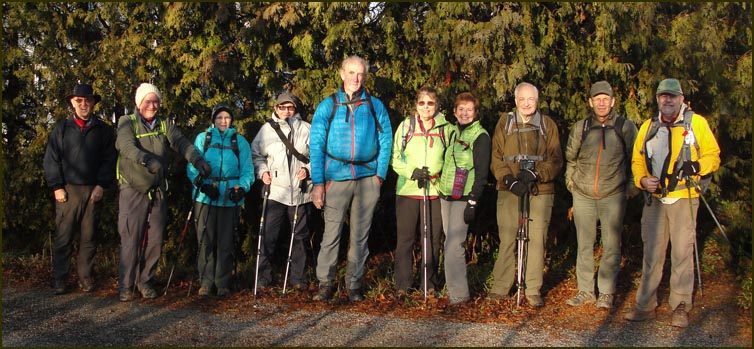
Today's hikers; Case; John; Carol; Anita; Michael; our leader Karen; Christine,; Andy; Steve
and John N.

We started the hike in Limehouse. We crossed over the railroad tracks
and turned left onto Kirkpatrick Lane which we followed to Fifth Line
and turned left. After 75 metres we left the road to the right.


We climbed a cliff on the right and hugged a field edge and passed through
a young forest before climbing the side of a large drumlin.


We climbed our first stile .....

and ducked under our first low hanging tree....

We trod over our first wet and slippery rocks ....

and then climbed our second stile .....

and our third .....


We followed a series of field edges to rejoin Fifth Line and turned north.

After 75 metres we left the road to the right, crossing our fourth stile.


It was somewhat disconcerting to come across this sign
after having just taken a much needed 'bush break'.

We then crossed a creek and after skirting the edge of some open fields.

Crossed a swamp on a very wet and slippery boardwalk
(the first of many)

Then climbed another stile (I've lost count) at the Sixth Line, and
turned north towards Hwy 7.


Turned east and followed the road for 700 m and turned left into the bush.


We passed through sections of wet and dry land and stopped for a
snack break before crossing Trafalgar Road.

After crossing Trafalgar Road we followed a 250 m board walk, still wet and
very slippery, to the high ground of the Scotsdale Farm.

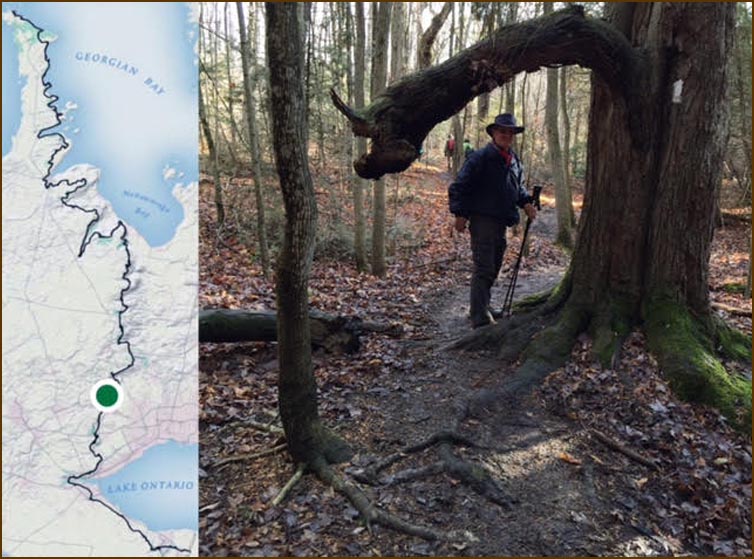
Karen took this picture. which includes our location on the Trail,
on her phone utilizing the Bruce Trail app. Love that technology !

We continued through a mature woods, crossed a bridge and headed into
a pasture.

We continued through a series of fields, woodlots and wet areas and crossed
the Eight Line Road Allowance. We followed Snows Creek north
to 27 Sideroad where the cars are parked.

"Ahhhhh"
more pictures to come ......


