This section starts at the Old Baldy Conservation Area parking lot and
ends at the Eugenia Falls lookout.
ends at the Eugenia Falls lookout.
The weather forecast was for rain but fortunately it held off until about 1 pm.
The temp was around 15 C.
The temp was around 15 C.

 |
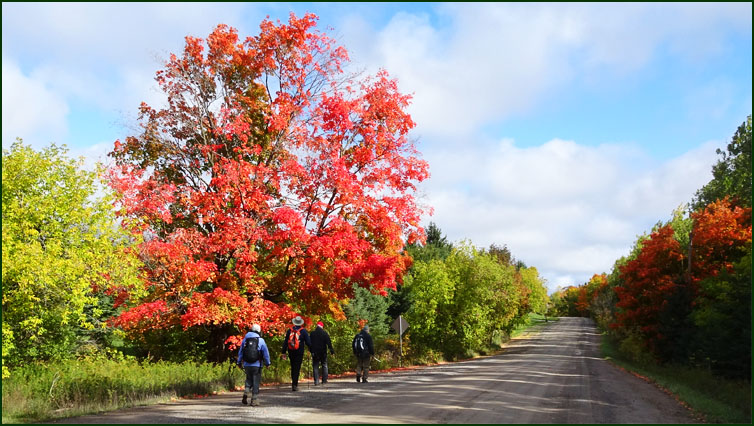
| Todays hikers; Richard; Annamarie; Eric; Bill; Annette; Leslie; Steve, our leader; David and Case. |
 |
| The Trail heads south from the Old Baldy parking lot. |


 |
| The Trail follows the Escarpment edge past several excellent outlooks. |

 |
| We reach the summit of Old Baldy where the Escarpment face is 50 m high. |
 |
| "Oh that's good, just a couple more steps Richard?" |
 |
| "Oops ..... " "Did you get a picture of that?" "Sure did." |


 |
| We hike west for 300m along Sideroad 48, turn right and follow the 4th Line A south. |
 |
| "Quit poking the Puffball Steve." |

 |
| The Trail turns west along the Artemesia-Euphrasia Townline Road. |
 |
| "This apple doesn't taste bad, yuk it has half a worm in it." |

 |
| How much topsoil does it take to get a tree started? |
 |
| We follow County Road 13 south for a short distance, then turn west, cross a stile and head for the edge of rhe secondary Escarpment. |


 |
| At noon Annette reminds herself not to pack Limburger Cheese for lunch next time. |

 |
| We pose for a group picture. Unfortunately for Annemarie there was a load limit of only six persons on the bridge at one time. |


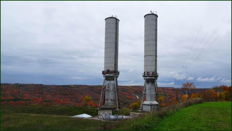 |
| A pair of surge towers that control the flow of water from Lake Eugenia to the turbines in the Ontario Power Generating Station in the valley below. |

 |
| "How much further?" "Four K." |
 |
| This arch and a similar one on the far side of this hill mark the ends of a tunnel that was built by the Georgian Bay Power Company in 1906 in an attempt to harness the power of the Beaver River. Shortly after its completion the company went bankrupt and the tunnel was filled in for safety reasons....... Speaking of safety, there's always someone.... |
 |
| The brink of Eugenia Falls where the Beaver River drops 30m to the valley below. |
 |
| The Trail follows the Beaver River upstream for a short distance, crosses a bridge and follows the river back down to the Eugenia Falls lookout. |

 |
| It was raining so we took a quick look at the fallls and headed for the cars in the parking lot. We met at the Tim Hortons in Orangeville for sustenance and headed back to Oakville. |