Thursday 30 April 2015

Niagara Km 70.6 to Km 80.4 - 30 April, 2015

Hikers: Case, Andy and Christine

Leader:  Karen

Section and Distance:  Niagara Km 70.6 to Km 80.4 (End of Niagara)

Weather:  Sunny and Warm with a little breeze

Actual Distance hiked:  10.68

This hike is a makeup hike for Christine, Andy and Case. It is also Andy's first hike since his accident last fall.

After positioning the cars, we started the hike at the Mountain View Conservation Area parking lot.

Starting the hike
Christine and Andy led the way and set the pace for the hike.  We climbed steeply to the top of the escarpment through a mixed forest to Walker Road. The trail was very rocky with lots of crevices and several ups and downs.  The floor of the forest was covered with wild flowers including trilliums, dutchmans breeches, dog tooth violets - also known as trout lillies, blood roots, violets, coltfoot and many others.

Dutchmans Breeches
A hillside of Dutchmans Breeches
Trillium

Violets
Unknown
Dog Tooth Violet (Trout Lilly)
Blood root
Coltfoot


We hiked Walker Road to Thirty Road before descending into a wooded area crossing Thirty Mile Creek at a waterfall.

Thirty Mile Creek
Thirty Mile Creek

We continued along the escarpment through woods and clearings over stream beds to Park Road.


Elevensies

We climbed Park Road to Ridge Rd. East following Ridge Rd. East for 200 metres to a steep downhill through the woods.  We followed the crest of the escarpment back to Ridge Road which we followed for 500 metres.  After passing the intersection of Russ Road we entered a road allowance and continued along the escarpment brow and steeply climbed to the intersection of Mountain Road and Ridge Road.


Steep downhill
We continued along Mountain Road for 50 metres before turning left onto the Escarpment.  We descended steeply to Mountain Road.  After 100 metres we turned left onto Gibson Street and continued across the pedestrian bridge over Forty Mile Creek, the end of the hike.


What is this?


Welcome back Andy.  It was good to have you and Christine back on the trail again.

We took the Forty Mile Creek Side Trail back to our car. 

We retrieved the second car, met at Tim Hortons and went home.


Sunday 26 April 2015

Beaver Valley Km 42.1 to Km 56.2 - 24 April, 2015

Hikers: Case, Helgy and Steve

Leader:  Karen 

Section and Distance:  Beaver Valley Km 42.1 to Km 56.2

Weather:  Sun and cloud, coldish with some wind

Actual Distance hiked:  14.4

We enjoyed another great breakfast of yogurt and fruit compote, spinach quiche, orange juice and coffee.  Mel joined us once more.  After paying our bills we made arrangements to come again on May 5th when we hiked again on May 5th and 6th.

After breakfast we packed up the car and drove to the end point of the hike to drop of our car.  Mel then dropped us all off at the Old Baldy Conservation Area parking lot.

Starting the hike

From the Old Baldy Conservation Area parking lot we headed south along the cedar-lined Escarpment edge past several excellent viewpoints before reaching Old Baldy Lookout, where the Escarpment face is 150 m high.  We continued south past several lookouts.

View


We continued south to Sideroad 4B and then turned left for 300m before turning right to follow the 4th Line A south to meet the Artemesia-Euphrasia Townline Road.  We turned right and followed the Townline Road west.  We turned left and continued downhill through private land to reach Grey Rd 13.

In 2008 29 kms was added to the main trail which is now known as the Falling Water section.  We are now starting that extension.   On this section, you are never far from the sight and sound of falling water.

At the junction of County Rd 13 and the Artemesia/Euphrasia Towline we followed the est side of the road before turning right.  We then followed the edge of a high secondary escarpment with spectacular views across the valley to the west.  Also visible are large dolostone blocks which have broken away from the main Escarpment face and very deep vertical crevices.  We then crossed a private driveway and descended to the main scarp face and followed it into a rugged and deep re-entrant valley with a creek and waterfall.  We then climbed beside the creek and followed the scrap edge to the Ontario Power Generation property and made a steep climb beside the penstocks that carry water from Lake Eugenia to the turbines in the generating plant far below in the valley.  Once at the top, we turned south again to pass through another beautifully wooded park like property.


When we reached Cambell's Hill Road, we headed uphill a short distance and then turned right onto an unopened road allowance and followed a stream for a short distance and then headed south through a hardwood bush.  When we emerged from the bush we followed an unopened road allowance to the north limits of Eugenia North St. and followed its unopened portion to the right.  We soon turned left through second growth and then through mature forest before beginning to climb to the heights above Eugenia Falls and Cuckoo Valley.


We continued to a spectacular lookout at the Upper Valley before descending steeply to the falls.  Here we saw arches that mark the ends of a tunnel dug one hundred years ago in an abortive attempt to harness the power of the river.  We continued upstream and crossed a new pedestrian bridge over the Beaver River.


We left the last .2 km to do next time and hiked to our car.  We stopped of at Tim Horton's and drove home.  We all agreed it had been an enjoyable three days despite the weather.


Saturday 25 April 2015

Beaver Valley Km 27.9 to Km 42.1 - 23 April, 2015

Hikers: Case, Helgy and Steve

Leader:  Karen 

Section and Distance:  Beaver Valley Km 27.9 to Km 42.1

Weather:  Cold and Cloudy with a wind chill factor - a few flurries

Actual Distance hiked:  14.65


When we got up this morning there was about a 1/2 inch of snow on the ground and it was still snowing lightly.  We got dressed and went down to breakfast.  Diana had prepared a good breakfast of scrambled eggs, toast, bacon, sausage, yogurt and fruit compote, orange juice and coffee.

Although Diana had some objections, Mel joined us for breakfast.  Diana spent some time complaining about past guests.   Guess she wanted to make sure we did not do any of those things.

Leaving the B&B

After breakfast, Mel drove with us to the end of our hike where we dropped of our car and he then dropped us all off at the beginning of the hike.
Starting the Hike

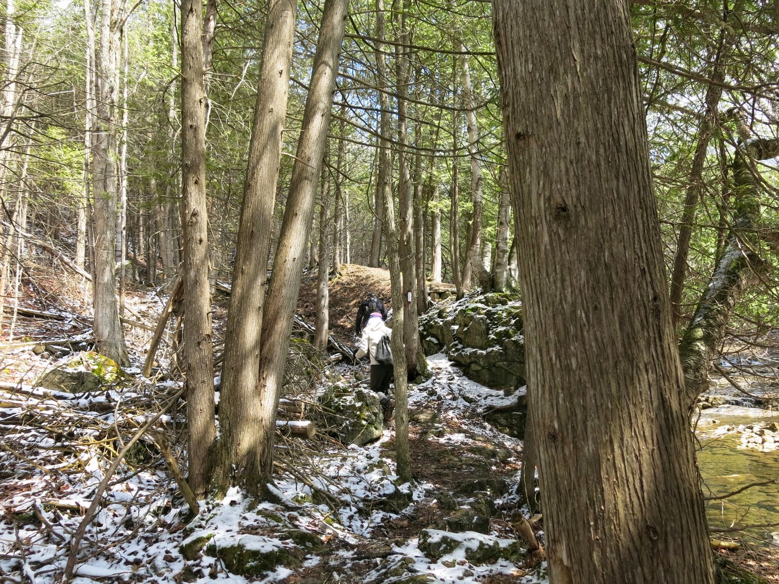
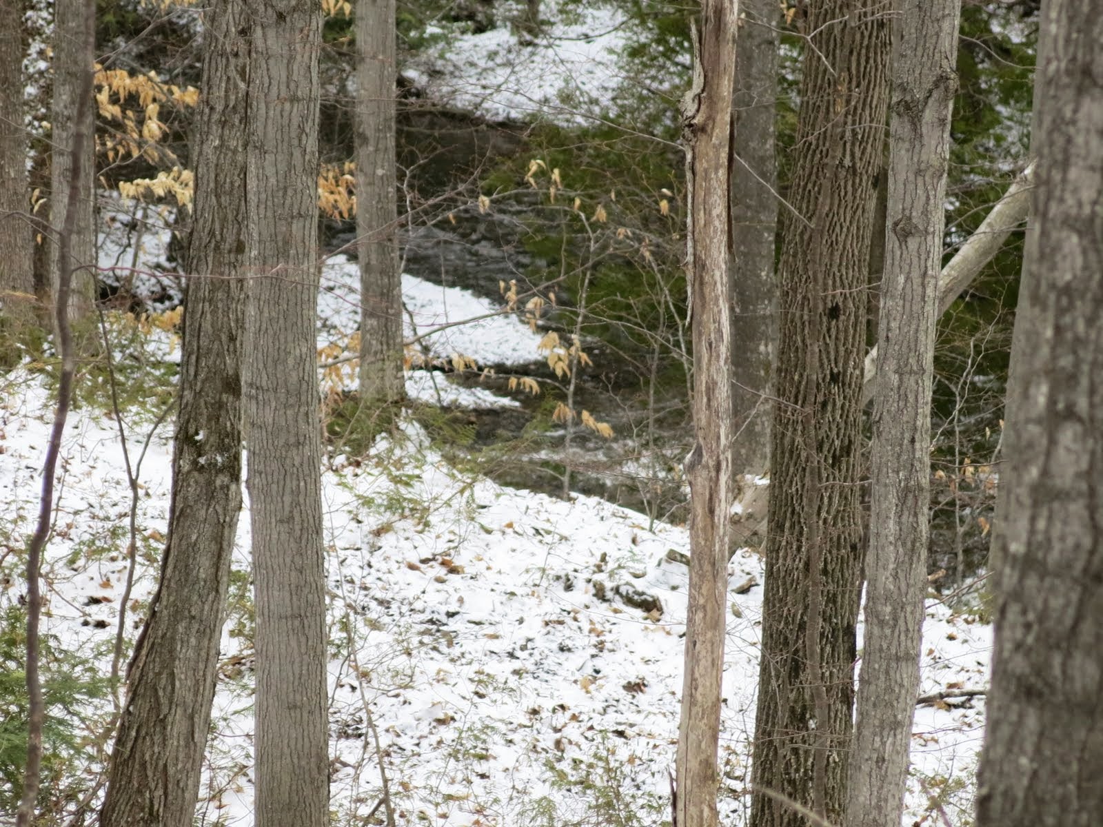
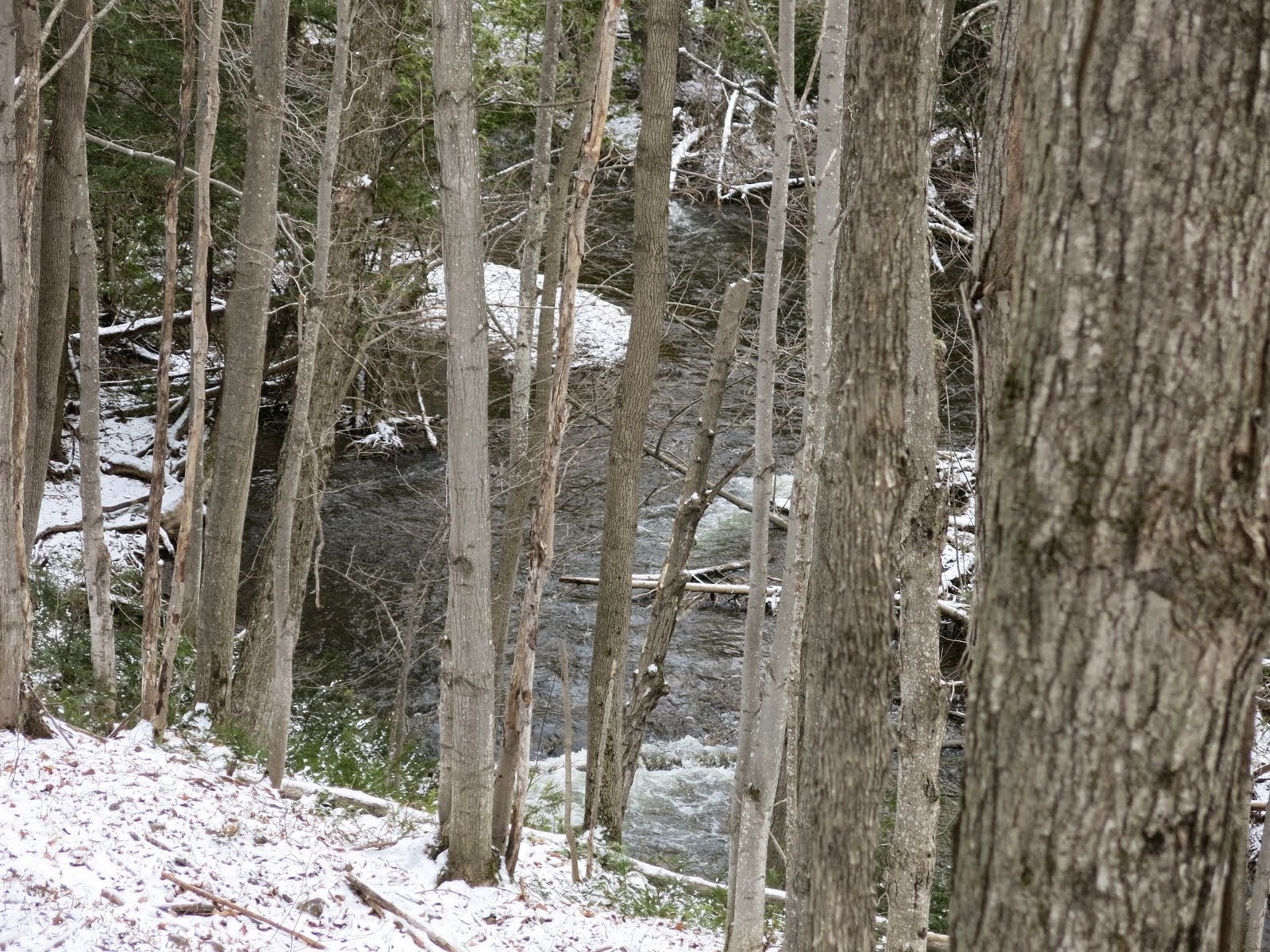
We crossed 10th line and crossed fields before turning left.  We then hugged the steep valley wall of Mill Creek south and crossed a bridge before taking switchbacks to the top of the valley. 


We then headed south and entered the Pinnacle Rock Nature Reserve, a 130 acre farm donated to the BTC in 2013 by the Richardson family.  This section of the Niagara Escarpment  includes provincially endangered butternuts, bobolinks, a wetland, a waterfall and the impressive Pinnacle Rock itself.


Pinnacle Rock

Pennacle Rock

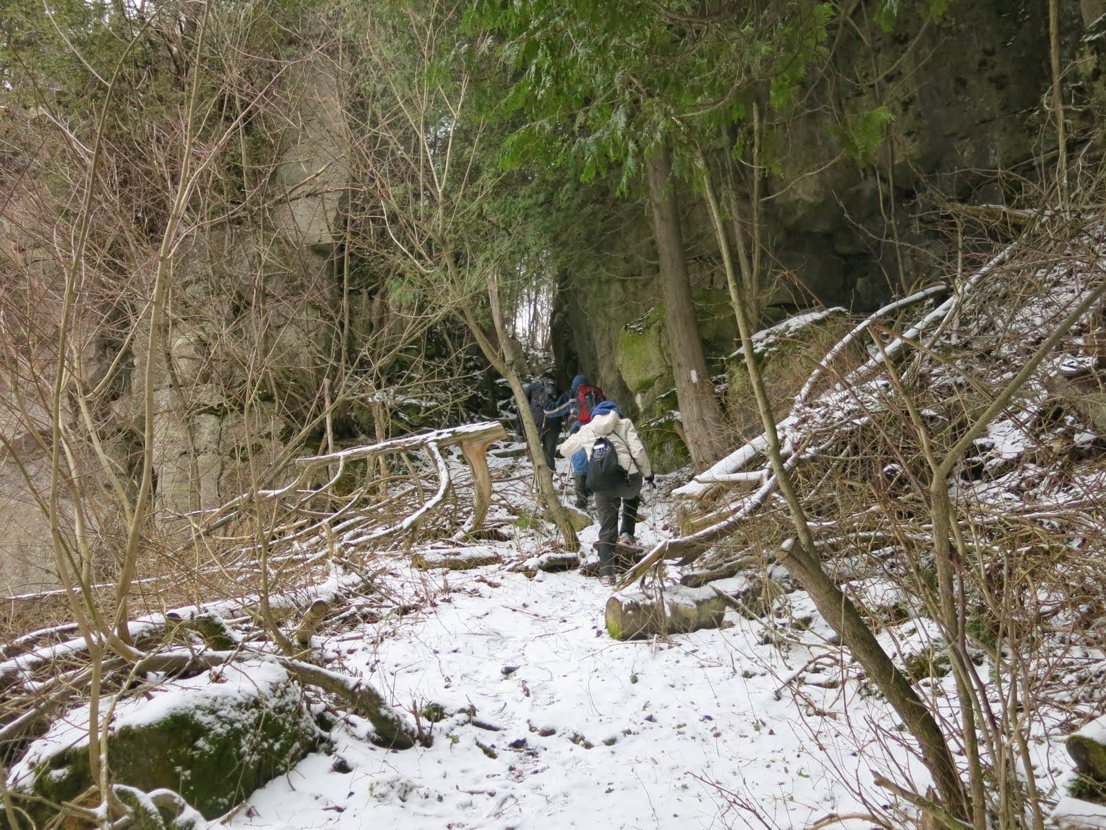
We then headed west and climbed to the base of Pinnacle Rock, a large piece of rock that has separated from the edge of the Escarpment.  At the top we turned right to follow the Escarpment.  To the right we passed the spectacular Duncan Crevice Caves.


We continued along to 9th Sideroad and turned left.  At the village of Duncan we turned right and followed the Towline Rd and Fox Ridge Rd to the 3rd Line. This road walk was very cold and windy and we all agreed it had not been our favourite part of the hike.   We then turned left and followed the road allowance south up the Escarpment until it arced to the right off the road allowance.  Soon afterwards we stopped for lunch.  We then descended across a scree slope.


Lunch

Lunch


 We followed the base of the Escarpment before ascending to the top through a spectacular natural pass.  Along the top we skirted McCluskey's Rock and descended a wide east/west valley before turning south.


We then joined Sideroad 7B and followed it south to the parking lot of the Old Baldy Conservation Area.

After the hike we drove a place Steve thought might be available to us when we are hiking in the area.  We all agreed it was beautiful place.

We drove to Meaford to Tim Horton's and then drove back to the B&B.

After cleaning up, we went back to the Leaky Canoe for dinner.  After dinner we went back to the B&B, watched a bit of TV and retired early for the night.  The weather looked more promising for tomorrow.  The forecast was for cold temperatures and sunshine.