Leader: Karen
Section and Distance: Beaver Valley Km 13.3 to Km 27.9
Weather: Coldish, Cloudy with the occasional ice pellets
Actual Distance hiked:15.3 km
At 8:00 today four enthusiastic hikers left Oakville to hike for three days in Beaver Valley in one car. The weather forecast was not promising - cold and rainy. We had also booked a B&B (Rocklyn Inn) in Rocklyn with taxi service. That meant that the cell phone had to work so that we we could let them know when to us pick us up. If the cell phone did not work in the area, we would need to find a land line somewhere. The owner of the B&B had asked us to call them an hour before the pickup. We decided that we would call them when we got to Grey Road 2 when we had less than 4 kms to go.
 |
| Starting the hike |
We parked our car at the start of the hike and set off hoping everything would go as planned. We followed the 6th line across a stream and turned right onto County Rd. 119 which we followed for 1.3 kms. We turned left and continued in a southerly direction across fields and streams.

When we reached the 12 Sideroad, we turned right and followed the road for 700 metres before turning left to enter pasture land. We then hiked through a deciduous woodlot and soon arrived at a small piece of history. It started sleeting as we entered the woodlot, but soon stopped. The floor of the forest was covered with new growth.

 |
| Dogwood |
 |
| Trilliums popping out (not yet blooming) |


 |
| Ice Pellets |


 |
| Enjoying the view |
 |
| The sun was shining in the distance. It never did get to us |


 |
| One of many views |

The Old Mail Road was a pioneer route into this area and was in use from the 1830s until the 1850s. It preceded the grid plan system of roads which was developed after the survey and as the townships were settled. Small parts of it still exist, including a small section of this woodlot - the landowner found 1851 and 1871 census maps which show the Old Mail Road meandering through this property.


 |
| Lunch |

We continued south to Grey Rd 19 and then hiked through a BTC property to reach Grey Rd 2. We called the B&B and where happy that the cell worked. We told them that we still had a little less than 4 kms left and thought that we would complete it in a little over an hour. We also let them know that our boots were muddy and suggested they bring plastic bags to protect their car.
We crossed Grey 2 road and hiked westward through a field along a cedar-covered ridge. We then made an abrupt left turn to Metcalfe Rock. At the summit of Metcalfe Rock there was a splendid view across the Mill Creek Valley.


 |
| Wild Flower |
 |
| Wild Flowers |


When we got to the Metcalfe Crevice Side Trail, which we decided we would hike. We descended the escarpment through a rocky gorge 30 m high, where huge slabs of dolostone have broken away to form crevices containing several caves. While in the crevice we got a call from the B&B asking where we were because Mel (our driver) had been waiting for a while. We told them that we were about 10 minutes away from completing the hike. This side trail is very challenging under normal conditions and it was made even more challenging by the ice and snow still in the crevice.


 |
| Metcalfe Rock |
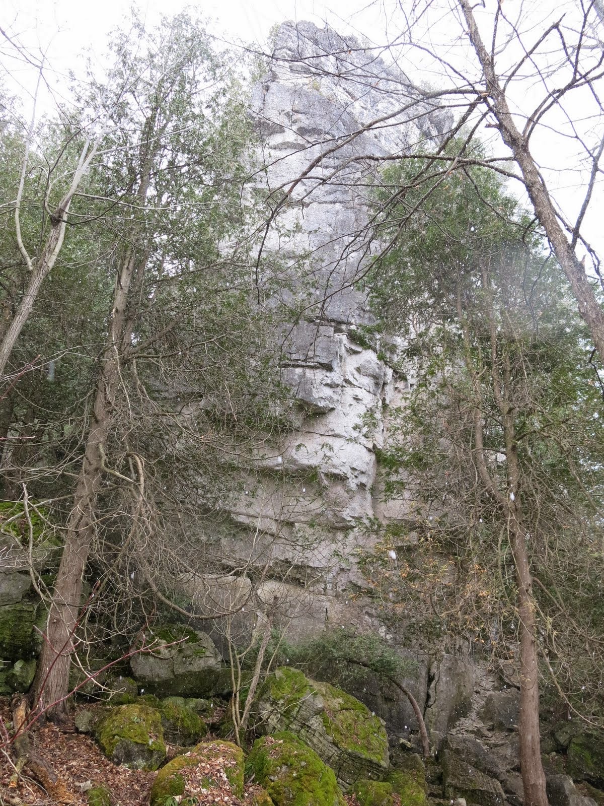 |
| Metcalfe Rock |

 |
| Violets
We drove to the start of the hike and picked up our car and followed Mel to the B&B.
We chose our rooms after getting the lowdown on the rules of the B&B. After showering we went into Meaford for dinner at the Leaky Canoe which was recommended by Diana and Mel. It was a very good recommendation.
The weather forecast for tomorrow was not promising - cold and snow.
After watching a bit of hockey game we retired early.
|
No comments:
Post a Comment
Note: only a member of this blog may post a comment.